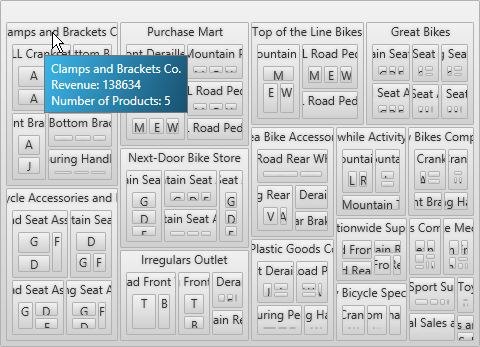
The following table summarizes the new features of the Ultimate UI for WPF 2013 Volume 1. Additional details are available following the summary table.
The Infragistics Syntax Parsing Engine is a set of classes capable of taking a definition for the grammatical structure of a type of document and producing analyzers to read and process those documents.
Main features:
Creating analyzers
Performing analysis
Other features:
Analyzing grammar
Identifying Errors and Ambiguities
Generating C# and Visual Basic language class files
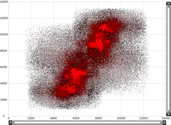
The xamDataChart control’s HighDensityScatterSeries can bind and show scatter data ranging from hundreds to millions of data points with minimal loading time. The series displays the scatter data as tiny dots as opposed to full size markers due to the fact that there are so many data points. The area with the most data is displayed with the higher color density, like a cluster of data points.

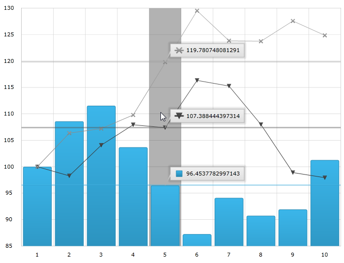
Chart Annotation Layers are implemented through hover interaction layers which are series that are added to the series collection, and are dependent on the cursor’s position. Adding the hover interaction layers to the xamDataChart control disables the default behavior of crosshairs, tooltips or both depending on the type of the added layer.
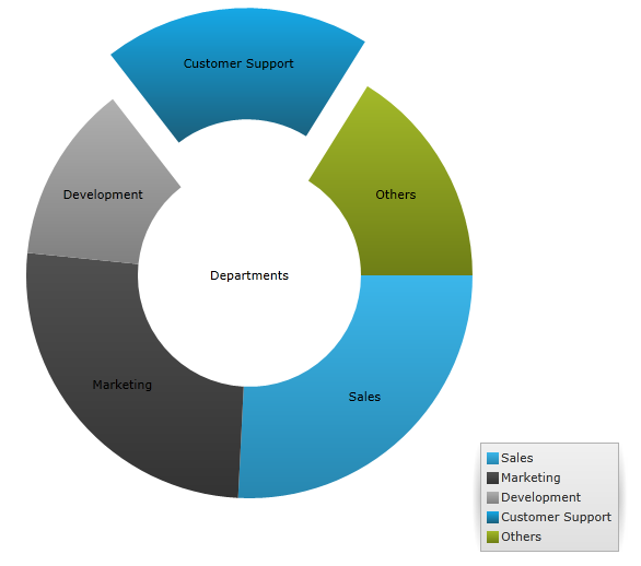
The xamDoughnutChart control is similar to the xamPieChart –proportionally illustrating the occurrences of a variable or multiple variables in concentric rings and provides built-in support for visualizing hierarchical data.
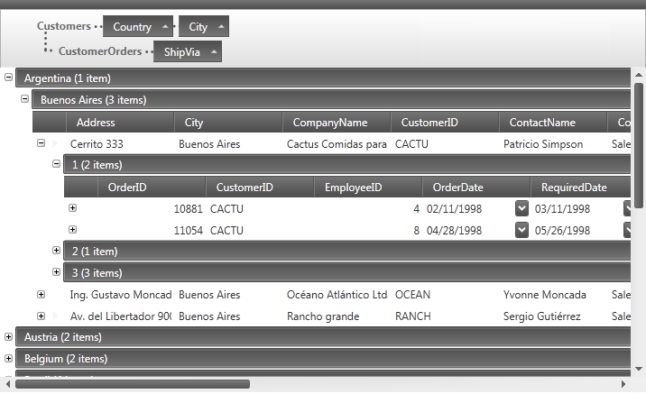
The control offers new sorting capabilities via the UI or using code.
The new grouping behavior allows users to group data into more readable and navigable arrangements.
The control provides the ability to save the current project plan to a MS Project XML file.
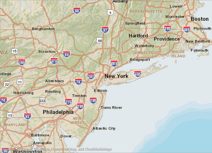
ArcGIS Online is an Esri product that allows you to create and share maps either publicly or privately. You can also access other maps created by Esri and other ArcGIS users.
You can see a partial list of available public maps at the Esri Maps and Data Group.
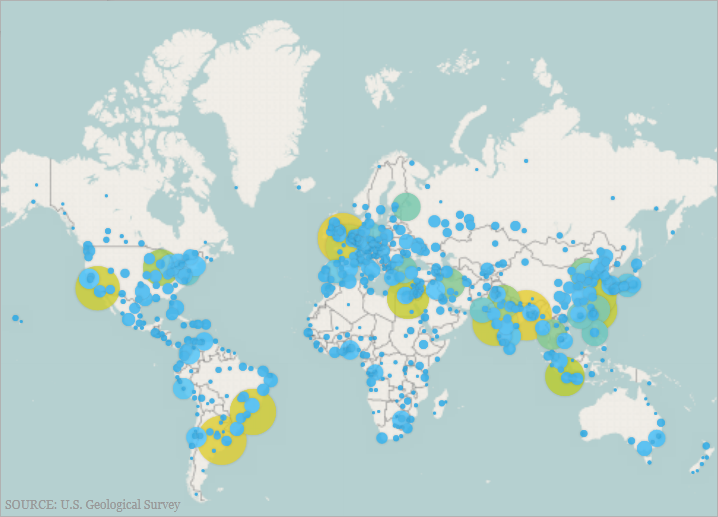
The GeographicProportionalSymbolSeries is a Scatter Series, the size of whose symbols are data-driven. It implements GeographicSymbolSeries and has all the basic characteristics of the xamDataChart control’s BubbleSeries.
The following screenshot preview of the GeographicProportionalSymbolSeries series in the xamGeographicMap control displaying the locations of the most populated cites in the world. The SizeScale of the symbols uses proportional radius scale in order to indicate the significance of these cities based on their population.
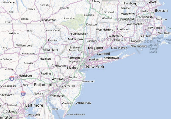
The simplified Bing Maps interface allows you to access Bing Maps with minimal setup. Previously, you had to configure a REST services to access Bing Maps and get the required URIs for the titles. With this release, this functionality is now built-in to the xamGeographicMap control.
The following screenshot previews how the xamGeographicMap control renders using Bing Maps Service’s Road map style of geographic imagery.
The GeographicTileSeries is a visual map element belonging to the xamGeographicMap control that superimposes additional tile imagery over the base tile imagery defined in the xamGeographicMap control’s BackgroundContent property.
The GeographicTileSeries is similar to the GeographicPolylineSeries except that the polylines function to clip the tile visuals rather than draw polylines.
The current state of the xamPivotGrid is defined primarily by the data source control used ( FlatDataSource™ and XmlaDataSource™). This feature allows you to save, and subsequently load, the current state of the data source.
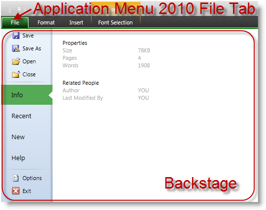
When enabled, the Application Menu 2010 feature renders a File Tab before all other tabs in the xamRibbon control. Pressing this tab will open a backstage, which will cover the xamRibbon groups and extends to the size of the window containing the xamRibbon. The screenshot below shows the location of the Application Menu 2010 File Tab within the xamRibbon control and an opened backstage
The control exposes new events for supporting clipboard operations.
The current line highlighting feature highlights the line containing the caret.

Adornments are visual elements displayed in the control’s text editing area that display visual user cues.
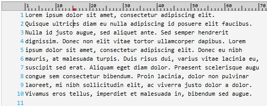
The ruler margin visually indicates the location of the caret in the current line with a customizable colored dot.
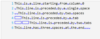
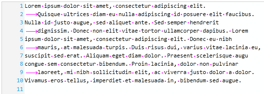
The whitespace highlighting feature allows you to indicate all of the places in the document occupied by spaces and tabs.
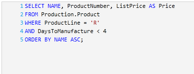
The Transact-SQL language is now supported by the xamSyntaxEditor.
This control exposes new properties making it easier to use and style tooltips.
